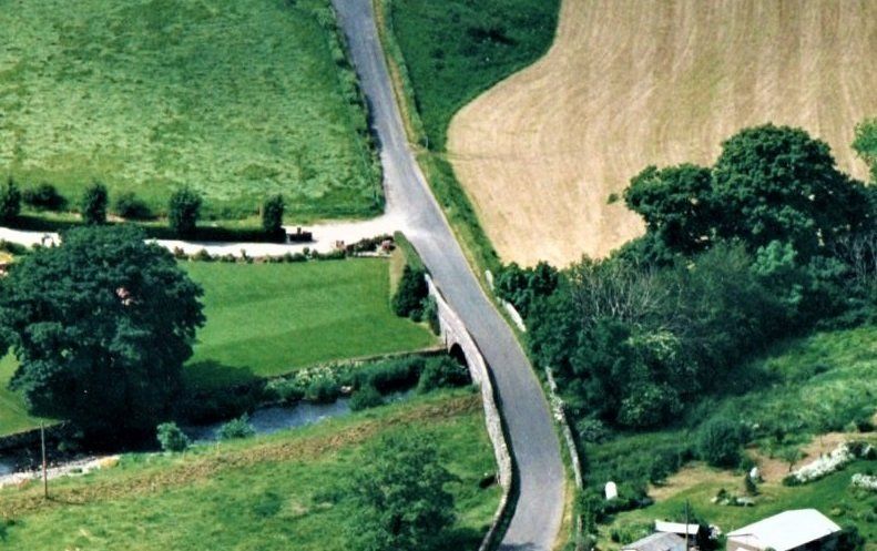
Apparently, Henry Little has given permission for the raised land, (river edge bund) immediately below the bridge to be lowered allowing flood water to access the flood plain, (his low lying field) as soon as it passes through the bridge.
Comment: The funnelling effect of the bridge only allows a certain amount of flood mode water, (combined volume/current) through the arch at a specific time, and no more.
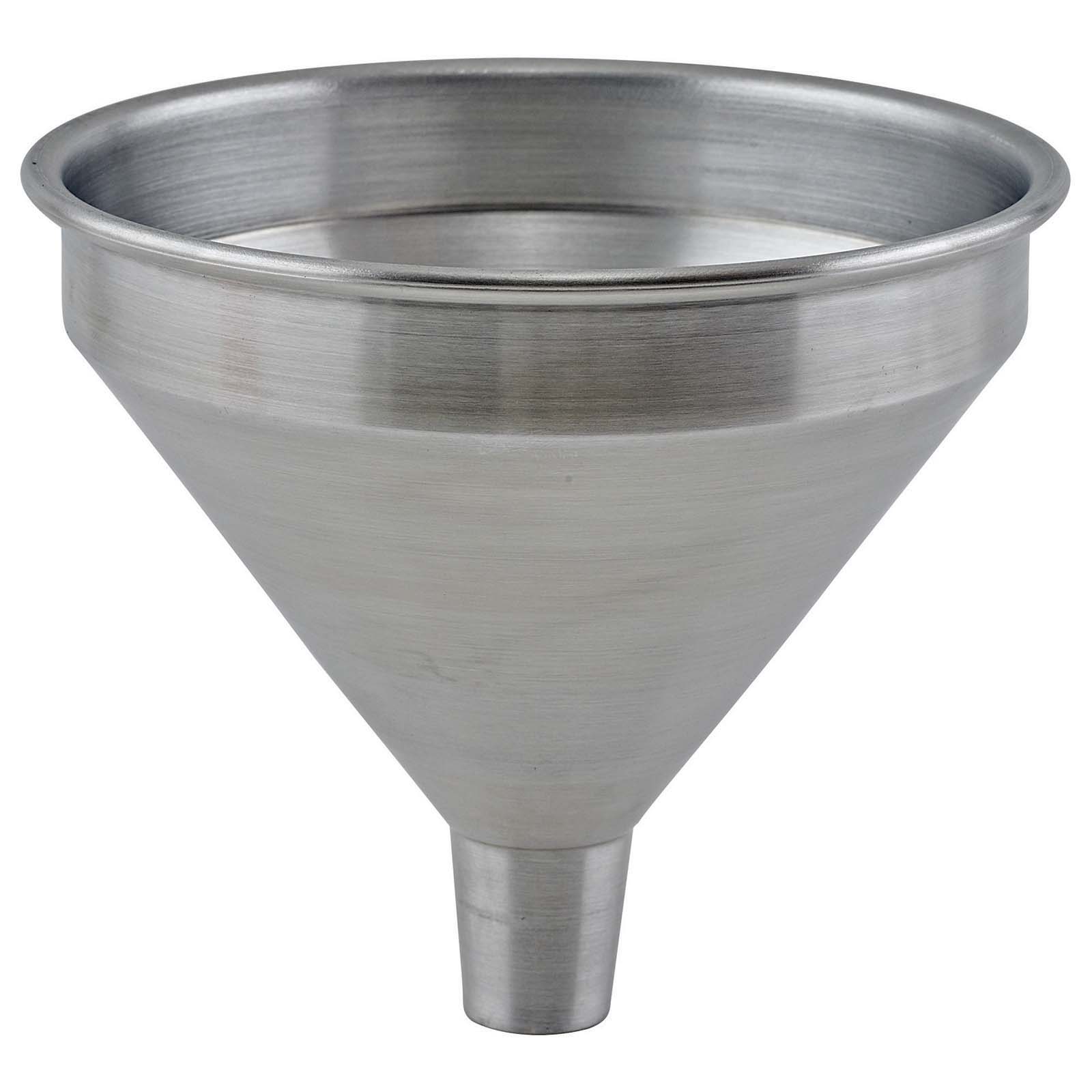
Just a simple experiment with a household funnel will reveal that it has limitations of how much flow capacity it can handle. When the liquid "input" is increased, the "output" flowrate does not follow up, but remains minimal, the funnel then stacks and overflows.
On a larger scale, MILLHOUSE
Bridge has the same phenomenon, which becomes seriously overwhelmed during extreme storms, unable to accommodate the sheer volume of the inflamed river in full spate.
The aerial photo below was taken in 1997 prior to the errection of the obstructing wall and raised level drive. During these times when the bridge became overwelmed the overflowing river used to free-flow across the road into the ajacent field.
But now, when the river becomes swollen during extreme storms, it completely overwhelms the 120 year old single arch bridge, (now deprived of it's original overflow path), to induce it's function to become a "dam". It then routinely funnels/stacks the river to unprecedented levels upstream, and to the mercy of the vulnerable properties in the village.
The bund bordering the flood plain, (Henry's field) plays NO part in this routine, therefore it needs to be retained.
By carrying out the proposed quite unnecessary work, (on the lower side of the bridge) on Henry's river bank will NOT IN ANY WAY increase the flow capacity of the bridge,
but just undo valuable work done early last century to prevent the field flooding during relatively lower levels of the swollen river.
Henry needs to be justly warned that by removing or flattening the bund in his field it will cause his field to flood much more frequently during relatively lower river levels, during regular periods when there is absolutely no threat to the village,
(which is why the bund was initially installed by the Summers, who owned the field at the time). Henry will have no alternative but to move his livestock out of this low lying field during these more frequent periods.
Also, Henry needs to be reassured that he will not have to foot the bill for the reinstallation of the bund himself, when it is discovered what happens! The "orriginal overflow path for the bridge" used to convey the excess flood water to Henry's low lying field/flood plain very efficiently,
"and only when required".
The sooner the original overflow/by-pass for the river Caldew bridge is reinstated, the sooner the properties in MILLHOUSE
will actually become desirable and marketable, (as they used to be).
Sadly, another flooding event and more hardship may have to be experienced before the-powers-that-be individuals are completely convinced about the very realistic and proven facts laid out on the pages of this website.
For the sake of the inhabitant's future welfare and the crucial sustainability of property value/demand, this website has gone to great lengths to demonstrate in detail how the village of MILLHOUSE
has been inadvertently reintroduced to regular flooding from the river Caldew, undoubtedly caused by rapid multiplying stacking behind the low capacity bridge, inflamed by inadvertent significant man made changes on the west bank in 2003.
This website uniquely demonstrates via an intricate photo Survey, the recently reintroduced flooding phenomenon to MILLHOUSE
:
The quite unique photo survey was carried out soon after the storm Desmond flooding event, with the full intentions of it being a vital aid to provide realistic information to the Environment Agency, to enable a necessary fast-trac remedial plan to be promptly put in to action.
To date, NO such (credible) plan has been instigated.
The reintroduced flooding routine is completely reversible, with a very logical common sense credible
rectification to the inadvertent man made changes.
The reintroduced flooding routine commenced in 2005, after a break of more than 40 years. MILLHOUSE
enjoyed a blissful Holiday from river orientated flooding, onwards from the completion of the long awaited construction of the village flood defense bank in the 1960's. It was during this period of 40 years when most of the recent flood victim residents of
MILLHOUSE
bought their homes at a then sustainable market value. The January 2005 flood event was a rude awakening, when unprecedented stacking was experienced behind the 110 year old single arch low capacity bridge, (Funnel/Dam).
3 more repetition flooding events have since occurred, undoubtably due to the incapability of the low capacity bridge, now deprived of its overflow bypass by the 2003 man made changes:
November 2009,
June 2012,
and storm Desmond December 2015.
Until the recommended logical credible remedy is carried out to rectify the low capacity bridge, (now deprived of it's original overflow path) the vulnerable properties of MILLHOUSE
have an unsustainable flood resilience.
The realistic facts are that the vulnerable properties of
MILLHOUSE
will be flooded once again during the crescendo of the next extreme storm if no logical action is taken to rectify the serious problem of the low capacity bridge.
___________________
We do welcome you to offer your views about the 4 reintroduced flooding events within the space of a decade which MILLHOUSE
has endured since 2005.
(a) Is this phenomenon of 4 repetitive flooding events, and the 2003 blockage of the bridge overflow path just coincidence?
(b) Can global warming be to blame for the 4 flooding events?
(c) Are extreme storms more severe than they used to be?
(d) Is the capacity of the MILLHOUSE
single arch bridge realistically
large enough for the river Caldew in full spate during an extreme storm?
(e) Has the repetitive flooding phenomenon increased or decreased the value and demand of properties in MILLHOUSE
and the associated community post code?
(f) Are you willing to offer support towards a united front to push for a logical common sense remedy to get the repetitive flooding phenomenon rectified permanently?
(g) Are you willing to just sit back & take your chances that it may not happen again?
(h) Would you like the property values/demand in MILLHOUSE
to become more sustainable?
If there is any individual who is critical of the presentation of the flood oriented pages of this website, please we do welcome them to compile an alternative presentation (in detail) demonstrating a different credible opinion of how MILLHOUSE
flooded during the crescendo of storm Desmond, and also include the 3 major flooding events prior to Storm Desmond.
But do please remember that the entire dialogue and unique flood aftermath images on this website are protected strictly by copyright.