The parish of Castle Sowerby probably derived it's name from "Castle How", and a Castle named "Sowerby Castle", which existed between the 10th and 13th centuries.
http://www.gatehouse-gazetteer.info/English%20sites/378.html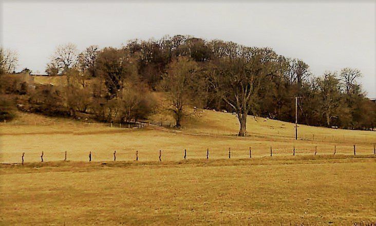
The Castle, of timber construction, was situated on the summit of this, (now wooded) Castle how hill which overlooks the present day "Hall Field" and "Bank End" farms

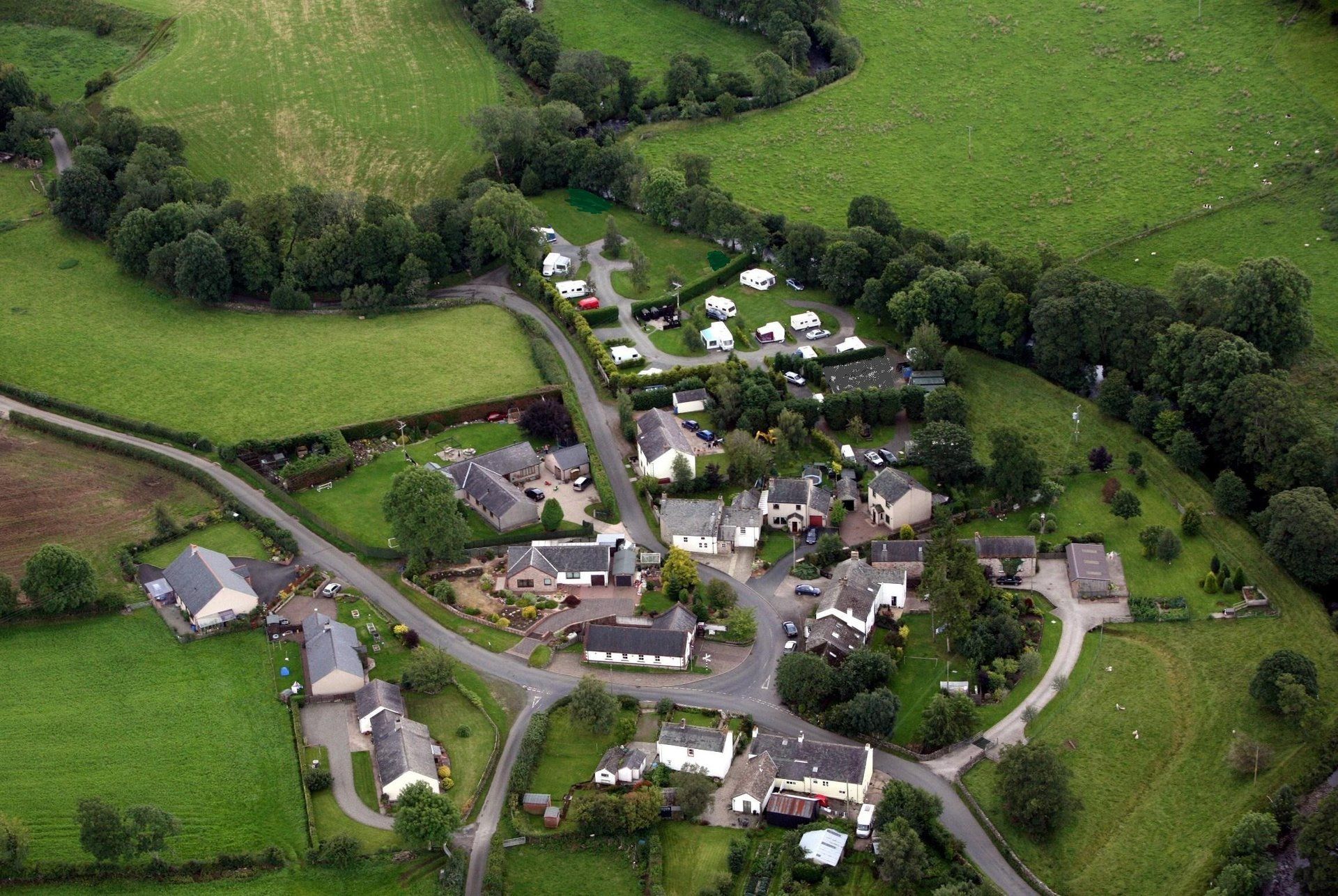
The Hamlet of Millhouse is actually the largest community in the parish of Castle Sowerby.
It is fair to say that MILLHOUSE
has been the parishioners fore front meeting place for countless generations
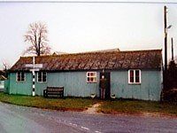
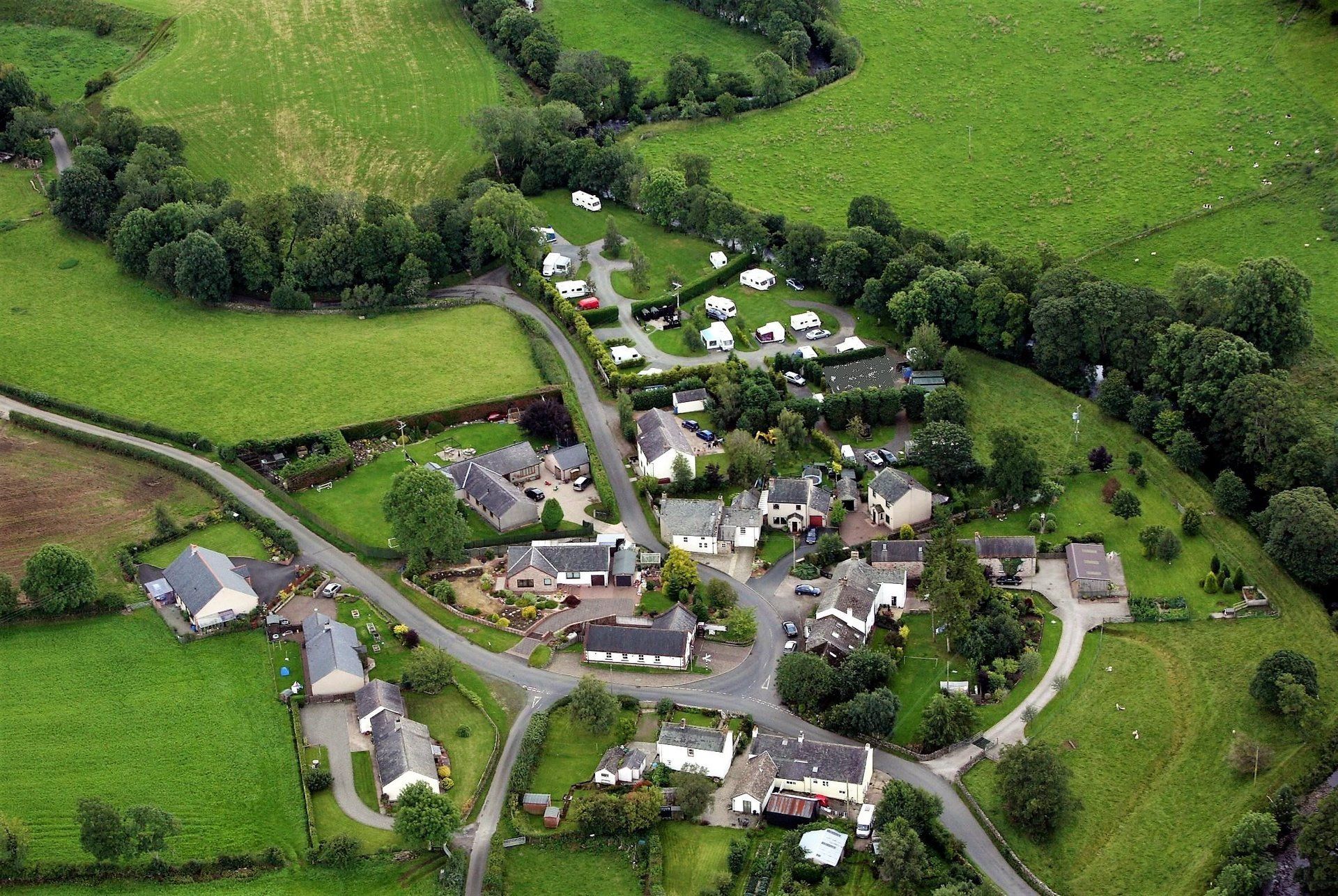
The old Hall, or Reading Room as it was locally named, was built by local people during the early 1900's. It was originally used mainly by local residents, farm workers and people employed in the area, as a recreational room to read, play snooker/billiards, darts and cards etc, before the luxuries advent of electricity, radio and television. The Reading Room was at that time a cultural step-up from a den in an old ruin of an ex-pub building, nick-named the "Dogs Home" which was the original meeting place
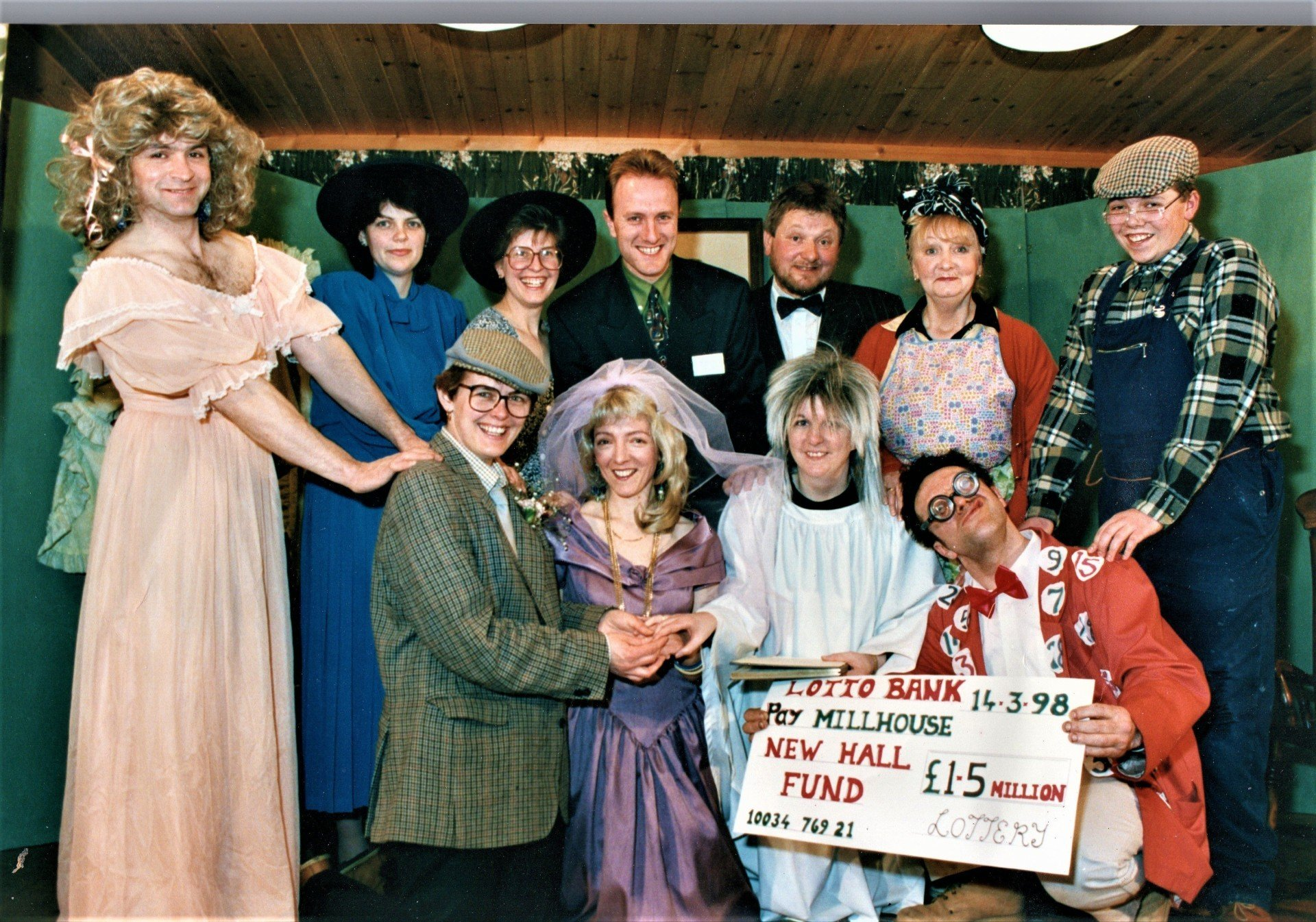
Various light-hearted fund raising events were enthusiastically carried out by locals to obtain an initial deposit to build the new hall, from which the National Lottery agreed to supply the remainder. One of the first fund raising events was a play, written and produced by Diane Scott, and was performed at Sebergham village hall.
The welcomed completion of the new village hall in 1999 has brought social gatherings and business meetings up to a modern recognised standard, and effectively contributed towards a noticable unity of the parishioners.

MILLHOUSE
is at the border line junction of not just one, but 2 other parishes. The river Caldew is one of the borders, the Gillcambon beck the other. If you stand at the junction of the two rivers in the caravan park, (being in Castle Sowerby parish) you can throw a stone over the Caldew to land in Caldbeck parish, and then throw a stone over the Gillcambon beck to land in Mungrisdale parish.
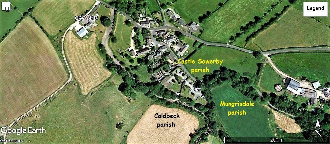
And adjacent MILLHOUSE, the river Caldew and the Gillcambon beck also form the eastern border of the Lake District National Park.
MILLHOUSE
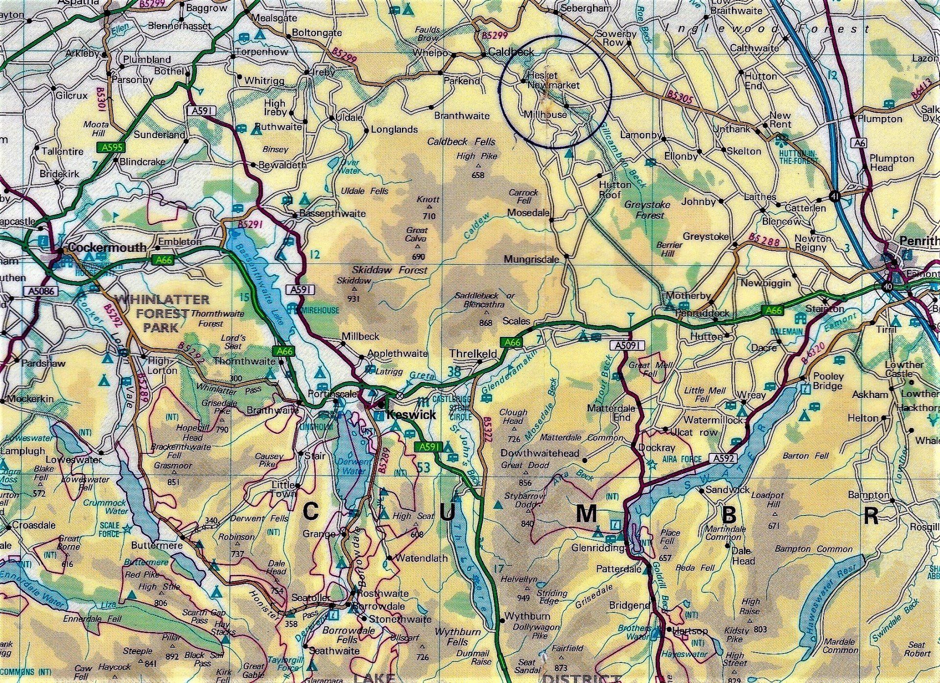
is an easy, straight 9 miles from Junction 41 of the M6.
MILLHOUSE
is also situated beside some of the best walking territory in the Lake District,
the scenic "Northern Fells" which are only 2 miles away.
The link below is brimming with information about the Northern Fells.
the scenic "Northern Fells" which are only 2 miles away.
The link below is brimming with information about the Northern Fells.
And the 2 main local villages of Hesket Newmarket and Caldbeck are close-by.
____________________________________________________________________
The SAW MILL
The village took on it's name from the mill, which was probably one of the first structures on the location, which started life orriginally as a corn mill, later being adapted to a saw mill.
The Saw Mill at MILLHOUSE
was very important to the area during the late 1800’s, early 1900’s. Both Hardwood and Softwood trees were cut down locally, and transported by horse drawn timber wagons to MILLHOUSE
Saw Mill to be cut into large planks, then seasoned in racks before being cut again into usable sized building timber. During the early times, the only power source for the Saw Mill was from the river Caldew. A large water wheel was powered via a Millrace and Sluices, from a Dam in the river. However, the Saw Mill, being water powered, had a serious handicap during periods of low rain fall. This stretch of the river Caldew has a rapid rise and fall reaction to weather. The location of the mill was so near to the river catchment area of the nearby Northern Fells and their rain reliant water courses. During the summer months there were many periods of too little water in the river. The operation of the water powered saw had to organised to coincide with periods of rain. This rapid rise & fall factor also eventually sealed the fate of the Mill Dam, as it was irretrievably damaged during a period of extreme, relentless rain fall, all in the space of a few hours, one day in the first half of the last century. (Extreme rainfall is not just a newly introduced 21st century global warming phenomenon). An internal Combustion engine was then installed as the main source of power. In turn, the engine was irretrievably damaged by severe frost, later in the mill's history.
_________________________________________________________________________
The SMITHY
The Smithy was a work station which virtually every resident in the area would need to associate or trade with. It’s main function was probably making shoes for horses, then doubling as a farrier to fit them. It also specialised in the repair/making of horse carts, and cart wheels and the making/applying/replacing the steel outer wheel hoop on an external horizontal hooping stone. The joiner from the Mill would work together with the Blacksmith to do the wood bits. The Blacksmiths business would also entail the making and repairing of tools, farm horse implements and animal associated equipment. The forge would be used to create everyday items, that these days we take for granted and just buy. In those days they had to be locally hand made.
_______________________________________________________
The PUBS
Yes Pubs! There were 3 of them in MILLHOUSE.
The Crown Inn, which is now divided into two Houses, (Smithy Cottage & The Mill Cottage). The Red Lion Inn, which is now Fell View, and the third Pub which was situated behind where the new hall has been built, which fell into dis-repair and finally had to be demolished down to a level of 5ft. The 5ft high outer walls still exist. In those days, if you wanted your pub to have plenty of business you made sure it was situated next to a Smithy or a Mill, as their clients were automatically tempted towards the pub, with probably any legal closing hours being somewhat ignored. It’s probably fair to say that some wives would not see their husbands for days. These days in the 21st century, husbands have a shed. In those days husbands had MILLHOUSE.
The Dwellings. Up to 1970, the total sum of dwellings in MILLHOUSE
was 6.
By the year 2010 this number had increased to 15.
4 semi-detached Houses
6 detached Houses
5 detached Bungalows
1 new village Hall
By the year 2010 this number had increased to 15.
4 semi-detached Houses
6 detached Houses
5 detached Bungalows
1 new village Hall
